The first thing the crew does is set up the total station on a tripod with a clear sightline across the ravine. In Aurora, that often means working along the steep banks of the Fox River or the Indian Creek tributaries, where the view is wide but the access is tight. A robotic total station paired with a handheld data collector lets us pick up every break in slope, seepage point, and distressed tree within half an inch, then feed that surface directly into a three-dimensional model. Back at the desk, that survey geometry becomes the mesh for a limit-equilibrium analysis using Spencer or Morgenstern-Price methods. When the stratigraphy includes the Lemont Formation till that underlies much of Kane County, we combine surface mapping with SPT drilling data to pin down the shear strength of the stiff clay and silt layers that control the failure surface.
Slope stability in the Fox River valley is not about whether the till will hold — it is about how much water gets into the fissures before it decides to move.
Technical details of the service in Aurora
Local geotechnical conditions in Aurora
The IBC Section 1804 and the City of Aurora grading ordinance both mandate slope stability evaluation when cuts exceed five feet or when structures are placed closer than the height of the slope from its crest. In Aurora, this is especially relevant because the Lemont Formation till contains discontinuous sand lenses that act as perched aquifers. A slope that stands at 2H:1V through a dry summer can unravel during a wet October when pore pressure builds in those lenses faster than the clay can drain. We model the transient seepage condition explicitly, applying the phreatic surface recorded during the wettest month of the local water year, not just the depth observed on the day of the site visit. For permanent cuts along detention basins or roadway embankments, we also evaluate the potential for progressive failure — the slow loss of peak strength that occurs when fissured clays are repeatedly wetted and dried over decades of Midwestern freeze-thaw cycles.
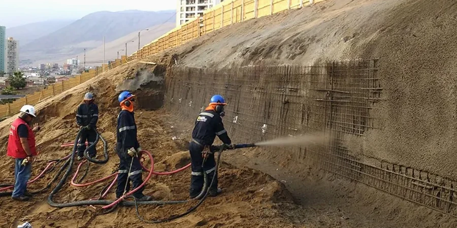
Our services
The slope stability work we coordinate in Aurora is not limited to a single report. It connects directly to the subsurface investigation and the earthwork recommendations that follow, so the deliverables are structured as a continuous engineering workflow.
Residential & Commercial Slope Stability Reports
Geotechnical analysis for single-family lots backing onto ravines, subdivision grading plans, and commercial detention basins. Each report includes stratigraphic sections, shear strength testing from split-spoon samples, limit-equilibrium back-calculations, and a clear statement of the minimum setback from the slope crest per City of Aurora requirements.
Construction-Phase Slope Monitoring
Deployment of slope inclinometers and observation wells during cut-and-fill operations near active waterways. We track lateral movement weekly during the excavation window and compare real-time deflection profiles against the predicted failure surface to trigger mitigation before the factor of safety drops below the design threshold.
Quick answers
What does a slope stability analysis for a building permit in Aurora actually involve?
The process starts with a topographic survey of the slope and a subsurface investigation using SPT borings or test pits to sample the Lemont Formation till and any underlying sand seams. Laboratory testing measures drained and undrained shear strength, and the results feed a limit-equilibrium model that calculates the factor of safety for rotational and translational failure modes under both static and seismic conditions. The final report includes cross-sections, the critical failure surface, and a geotechnical opinion on buildable area, all formatted for City of Aurora plan review.
How long does the city take to review a slope stability report?
The City of Aurora Engineering Department typically completes an initial plan review cycle within two to three weeks for a complete submittal. If the report references IBC Section 1804, includes the required factor of safety calculations, and clearly delineates the no-build zone relative to the property lines, the review tends to move faster. Resubmittals for clarification may add another week.
Does the Fox River floodplain affect slope stability on my lot?
Yes, especially for properties along the east bank where the river scours the toe of the slope during high-water events. Rapid drawdown after a flood can remove the stabilizing water pressure at the slope face while pore pressures inside the till remain high, which is one of the most critical loading conditions we model. The analysis includes a rapid-drawdown scenario calibrated to the FEMA flood stage for the reach adjacent to your parcel.
What is the typical cost range for a slope stability analysis in Aurora?
Can I build a retaining wall instead of doing a full slope stability study?
A retaining wall over four feet in height measured from the bottom of the footing to the top of the wall still requires a geotechnical report under Aurora's grading ordinance, and that report must address global stability — meaning the slope behind and below the wall. In many cases, a retaining wall analysis complements the slope study rather than replacing it, because the wall itself sits on a slope that needs to be checked for deep-seated failure.