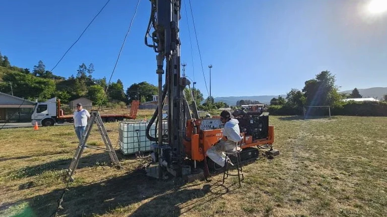
Aurora sits on a complex glacial landscape where the Fox River carved through layers of Wadsworth Till and outwash deposits, leaving behind lenses of soft clay and pockets of organics that boreholes often miss. The 1996 flood event demonstrated how variable shallow stratigraphy can be across Kane County, with areas of Yorkville moraine behaving very differently than the river terraces just half a mile away. Test pit excavation exposes these transitions directly. Our team conducts open-cut [exploratory test pits](/) using a tracked excavator to reach depths of 8 to 14 feet, logging soil structure, moisture conditions, and fill boundaries per ASTM D2488. For foundation design near the river corridor, combining visual pit logs with SPT drilling at offset locations gives a complete picture of bearing capacity and settlement potential.
Direct observation of stratification in a test pit often reveals what rotary drilling cannot — thin organic seams, desiccation cracks, and fill boundaries that control foundation performance.
Technical details of the service in Aurora
Local geotechnical conditions in Aurora
The excavator bucket teeth bite into the upper weathered crust near Indian Creek and the operator watches the sidewall for raveling — even a minor slough in saturated silty sand can escalate if the pit geometry isn't adjusted immediately. Groundwater in Aurora's river terraces often sits at 4 to 6 feet below grade in spring, creating seepage that softens the pit floor and complicates sampling of basal till. Confined space protocols are triggered if the excavation exceeds 4 feet and ventilation is limited; a gas monitor runs continuously when pits are located near former industrial parcels or buried utilities. Every pit is located after private utility clearance via ground-penetrating radar and vacuum excavation at marked crossing points — Aurora's older neighborhoods along the Fox have undocumented service laterals that records miss.
Our services
Our Aurora test pit investigations support a range of geotechnical needs, from foundation subgrade verification to pavement section design. We coordinate excavation, logging, sampling, and restoration as a single mobilization.
Foundation subgrade exposure
Open pits at footing locations to verify bearing stratum continuity, identify soft spots, and collect samples for laboratory strength testing before formwork begins.
Utility corridor investigation
Shallow test pits along proposed utility alignments to map top-of-rock, groundwater, and existing fill thickness — data that pipe designers need for bedding and trench support specification.
Quick answers
How deep can you excavate a test pit in Aurora's soils?
With a tracked 12,000 lb excavator we typically reach 12 to 14 feet in competent glacial till. Depth is limited by groundwater, sidewall stability in sandy layers, and benching geometry per OSHA. If you need deeper exposure we can combine pits with borings.
What does an exploratory test pit cost in the Aurora area?
Do you locate underground utilities before digging?
Yes, every pit is preceded by private utility locating using ground-penetrating radar and electromagnetic scanning. In Aurora's older sections near downtown, we also hand-excavate or vacuum-expose at marked crossing points because legacy service connections can be unreliable on as-built records.
What soil types do you typically encounter in Aurora?
The shallow profile is dominated by Wadsworth Till — a silty clay with gravel lenses — overlying stratified outwash sands and silts near the Fox River. We also encounter Yorkville moraine deposits on the east side, which tend to be stiffer and drier. Each pit log notes the specific unit encountered per Illinois State Geological Survey mapping.